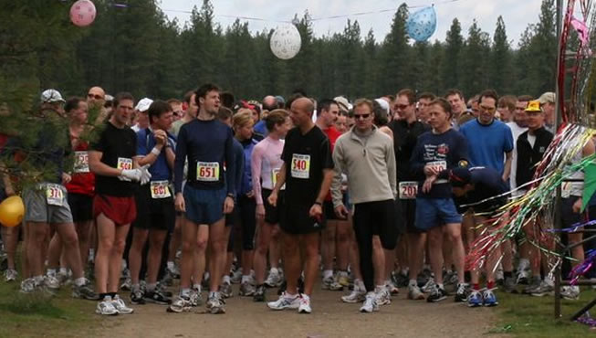
Spokane's only LOCAL NONPROFIT trail run, the Spokane River Run, is an annual trail run held in Riverside State Park just outside of Spokane Washington. We have 5 different races ranging from 5k to 50k; the courses are made up primarily of single-track trail that wind through the thick pine forests of the park between basalt cliffs and the roaring Spokane River. Spokane River Run is the primary fundraiser for the Garfield APPLE program, the event is completely staffed by volunteers and 100% of the funds raised go to the APPLE program and our non profit partners.
Looking for somthing new? Try the 50K relay. Take our awesome 50K course and break it into 4 great pieces. If you and your friends like our 10K think about putting a team together for this great event. See below for more info.
Also new, we have a YouTube page. Click here for videos of the course. Check back often for updates.5KThis is our shortest course, the route heads out on double track trails through the ponderosa pine forest. After approximately 2k the route turns towards the river where some small boulder gardens will require you to pay attention. When you reach the river you'll follow it back to the start/finish line.The 5K course has aproximatly 274 ft. of elevation gain.
Map is a living document and is subject to change based on weather and trail conditions. Mileage may vary.
If you'd like to see a Google Map of the course, click on the map. 10KThe 10K course winds along single and double track trails of Riverside State Park for 4-5K. Then turns down towards the Spokane River near the Devils Toenail rapid and follows the river along single track trails all the way to the finish line.
The 10k course has aproximatly 509 ft of elevation gain.
Map is a living document and is subject to change based on weather and trail conditions. Mileage may vary.
If you'd like to see a Google Map of the course, click on the map. 25KThe 25K course follows the first 4K of the 10K route but when the 10K turns back this route heads up hill going right up to the base of the basalt cliffs that Riverside State Park is known for. After climbing the cliffs the course turns east near the equestrian area and meanders through rolling hills and pine forest before climbing up to a bluff overlooking the Spokane River. You’ll then turn back dropping down to the Spokane River enjoying great views all the way back to the finish line.
The 25K course has aproximatly 1350 ft of elevation gain.
Map is a living document and is subject to change based on weather and trail conditions. Mileage may vary.
If you'd like to see a Google Map of the course, click on the map. 25K Challenge
This course is long and difficult with a significant elevation gain, several technical sections and a major climb. Most of the route is single track but is broken up frequently in the first 10k by pieces of double. The route winds through some of the less traveled areas of Riverside State Park passing through a basalt basin dubbed "craters of the moon" and climbing from the river near Deep Creek to the best view on any of our courses.
The 25K Challenge course has aproximatly 1900 ft. of elevation gain, which is why we call it a "Challenge".
Map is a living document and is subject to change based on weather and trail conditions. Mileage may vary.
If you'd like to see a Google Map of the course, click on the map.
50K
The 50k course is one long loop in the shape of a figure 8, which means the runners will pass through the start/finish area after completing the first 25k. Runners will then continue on a separate 25k loop. The first loop has significant elevation gain from the river all the way to the highest bluff in the park and is also the 25K Fun Run/Challenge course; the second loop contains less elevation gain and is also the regular 25K course. 50K runners are cautioned to not pass back through the Start/ Finish line once they have crossed it in order to prevent their time from becoming invalidated.
The 50K course has aproximatly 3250 ft. of elevation gain so come prepared.
The maps are living documents and may be subject to changes based on weather and trail conditions. Mileage may vary.
If you'd like to see a Google map of the course, click on the map.
Food items will be offered at several water stations along the 50K course
The 50k Drop Zone is located at the Start/Finish line and will be sectioned off. 50K Relay
If you and your coworkers are looking for a great bonding experience, take our 50K course and break it into 4 roughly equal pieces. Beautiful views, epic climbs and a memory your team won’t soon forget. The course is a figure 8 pattern where the first transition is midway through the first loop, the second is back at the start finish area and the third is midway through the second loop. Entries this year are limited to 30 teams so sign up soon.
The first leg runner will begin with the 50K race at 7:45 am
First Leg: One of the easier legs of the relay several small hills but mostly rolling single track. 8.75 miles
Second Leg: This is the most challenging part of the relay, significant hills and a section of rocky terrain. To make up for the difficulty this leg is only 6.75 miles.
Third Leg: This is also a difficult stage, not quite as much climbing as the second but still a challenge with a long rocky section. 8.25 miles
Fourth Leg: Probably the easiest leg of the relay, lots of rolling single track along the river and a few moderate hills. 7.25 miles
Combine both 25K maps (below the course descriptions) to see the full 50k course. The maps are living documents and may be subject to changes based on weather and trail conditions. Mileage may vary.
Packet Pickup
DirectionsFrom Interstate 90, take the Maple Street Bridge exit, Exit 280. Go north across the Maple Street Bridge, and angle left at the fourth signal light about two miles beyond the bridge. This puts you on Northwest Boulevard. Follow the Boulevard, with beautiful views of the park below, until it becomes Assembly. Stay on the road another mile north until it ends at Francis/Nine Mile Road (Highway 291). Turn left on Hwy 291 and travel approximately 3 miles. Turn left on Seven Mile Road. Turn left immediately after crossing Seven Mile bridge, the parking will be clearly marked.
From N. Division Y at the junction between Hwy 395 and Hwy 2. Continue South on Division street 1.7 miles. Turn Right on W. Francis Ave. follow for 3.1 miles. Francis turns into WA-291continue to follow for 2.1 miles. Turn left on to N. 7 mile road (also listed as W. Lowell Ave.) Turn left immediately after crossing Seven Mile bridge, the parking will be clearly marked.
For a Google Map to the starting area click here. Parking is in an open field. Please follow the parking official’s directions. Due to new legislation there is a need to obtain either a one day or annual Discover Pass. More information about the Discover Pass is located at discoverpass.wa.gov, or can be purchased at fishhunt.dfw.wa.gov. Start Times2016 Start Times
All Courses Close at 4:00 pm SupportThe following organizations provide the volunteers that allow for the Spokane River Run to flourish. 
If you or your organization would like to help provide volunteer support for this event, please please download the application form here and email it to SpokaneRiverRun@gmail.com along with any questions your group might have.
Beneficiary
Garfield APPLE and River Run also supports: Riversided State Park Foundation
F.A.Q.What Awards will be presented?
Where can I pick up my race packet?
What if I decide to run a shorter distance once I have started the race?
How many water stations are on the course?
Water stations are manned by Garfield A.P.P.L.E. elementary families. Their contributions keep this run alive.
Medical volunteer will be stationed at the main event site available to be dispatched out to course if needed. Each water station will have first aid kits on hand.
Will I need to carry any of my own water?
Is the course clearly marked?
Can I access a map of the course?
Will I be running any part of the course more than once?
Are pets allowed on the course?
Are strollers allowed on the course?
Will there be food?
Is lodging available?
Where is the closest ATM
Directions from the Start/ Finish area Please exit at the North end of the parking area. Make a left when you get to the pavement (N. Riverside State Park Dr.) Drive ¼ mile and make a Right on 7 mile road Follow 7 Mile Road ¾ of a mile turn right on 9 Mile Road. Follow 9 Mile Road for 2 miles, Zip Trip will be on the right hand side
|
|
| Spokane River Run |


| Home | Registration | Race Info | Race Results | A.P.P.L.E. | Photo Gallery | Sponsors | Contact |